The ruling military changed the name from Burma to Myanmar in 1989.
The two words mean the same thing, but Myanmar is the more formal version.
Total Land Area:
676,575 sq km / 261,227 sq mi
Main Geographical Features:
Bounded by Laos and Thailand to the southeast.
The mountain chains divide Myanmar’s three main river systems — the Irrawaddy, Salween (Thanlwin), and Sittaung rivers.
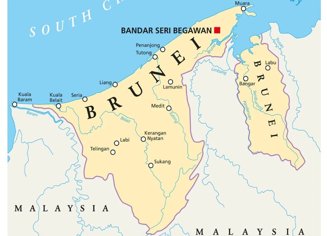
Capital: Nay Pyi Taw
GDP (in US$ Billion):
 Reduction in poverty and strong traction in tourism are expected to boost the economy.
Currency: Kyat (K)
Exchange Rate: MMK 1,851 / US$ (as of April 30, 2022)
Major Economic Sectors:
Key Exports: Oil and natural gas dominate Myanmar’s exports.
Official Language: Malay
Literacy Rate:
89% (2018) for adults aged 15 years and above
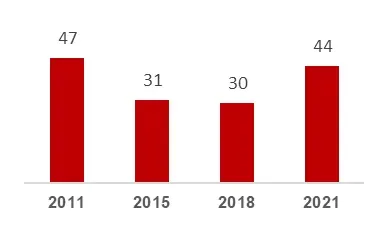
GDP Growth (%):
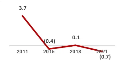 Brunei GDP is growing at >3% since 2015
Total Population: 54 million (2022)
Young population — extreme delays in marriage contribute to low population growth.
 Urban Population: 31%
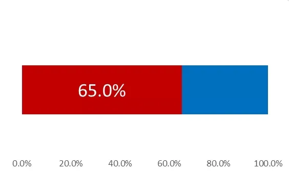
Labor Force Participation Rate:
Above the 66% ASEAN average
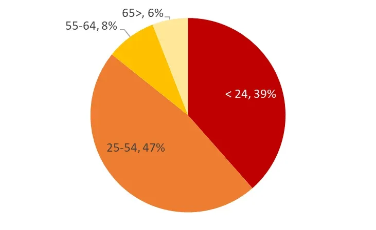
 Labor Force by Sector:
 US$
The GDP per capita in Myanmar is equivalent to 10% of the world’s average.
US$
The GDP per capita in Myanmar is equivalent to 10% of the world’s average.